Pavement markings are silent guides painted on our roadways that provide crucial information about how to navigate America’s complex network of streets and highways. These markings, along with various lane controls, form an essential visual language that helps drivers make safe decisions. Understanding this language is not just about passing your driver’s test, it’s about keeping yourself and others safe on the road.
The Basic Language of Road Markings

At their most fundamental level, pavement markings in the United States follow a simple color code. White lines separate traffic moving in the same direction, while yellow lines separate traffic moving in opposite directions. This distinction helps drivers immediately understand their position relative to the flow of traffic.
On two-way roads, you’ll often see a solid yellow line with a dashed yellow line beside it. This configuration tells drivers which side can safely pass. Passing is not allowed on the side with the solid yellow line, while vehicles on the side with the dashed line may pass when it’s safe to do so. Think of solid lines as firm barriers and dashed lines as conditional permissions; they’re telling you “you may cross under the right circumstances.”
Crosswalks and Stop Lines

When approaching an intersection with a stop sign or traffic signal, you’ll typically see a thick white line stretching across your lane. This is the stop line, indicating precisely where you should bring your vehicle to a complete stop. According to the Federal Highway Administration guidelines, you must stop before your vehicle reaches this line.
Crosswalks define areas where pedestrians have the right to cross the roadway. Not all crosswalks are marked, but those that are might appear as two parallel white lines or as a series of broad white stripes arranged in a ladder pattern across the road. In either case, drivers must yield to pedestrians in or about to enter a crosswalk.
In 2024, Iowa updated its traffic code to clarify that vehicles must yield the right of way not only to pedestrians on foot but also to those using any human-powered device, also known as a “pedestrian conveyance.” This includes wheelchairs, strollers, bicycles, skateboards, scooters, and electric personal assistive mobility devices. This trend toward more inclusive definitions of pedestrian movement is gaining traction across states.
Special Lane Markings
Reversible Lanes

Some urban areas optimize traffic flow by using reversible lanes, travel lanes designed to carry traffic in one direction at certain times and in the opposite direction at others. These lanes are typically marked by double-dashed yellow lines on both sides.
Before driving in a reversible lane, check for signs posted by the side of the road or overhead. Often, electronic signs with green arrows or red Xs indicate which lanes are available. A green arrow means you can use the lane, a red X means you cannot, and a flashing yellow X typically means the lane is transitioning or is only for turning. A steady yellow X indicates that the lane’s direction is about to change, signaling you to move out as soon as safely possible.
Shared Left-Turn Lanes

Many roadways feature a center lane reserved for vehicles making left turns from either direction. These shared left-turn lanes are marked on each side by a solid yellow line (adjacent to regular traffic lanes) and a dashed yellow line (on the inside). On the pavement, you’ll see left-turn arrows for traffic in one direction alternating with left-turn arrows for traffic coming from the opposite direction.
These lanes function as a temporary refuge for vehicles preparing to turn left, reducing the risk of rear-end collisions and keeping through traffic moving. However, they should never be used for passing or as a regular travel lane. Enter the shared turn lane only when preparing to make an immediate left turn.
Bicycle Lanes and Infrastructure

As cycling continues to grow as a transportation option, bicycle lanes have become increasingly common in American cities. These lanes are portions of the roadway designated exclusively for bicycle use and are typically marked by solid white lines along with bicycle pavement markings and signs.
Some bike lanes feature green paint to increase visibility. According to research from the National Association of City Transportation Officials, green pavement markings can reduce bicycle crashes by up to 38% at conflict points. Motorists should always look for cyclists before crossing these lanes and should never stop on green pavement.
In some urban areas, you might also notice “sharrows,” shared lane markings that indicate areas where bicycles and vehicles share the same space. Unlike bike lanes, sharrows don’t designate an exclusive space for bicycles but alert motorists to the likely presence of cyclists.
Another bicycle-specific feature appearing in more cities is the bicycle box, a designated area at the head of a traffic lane at a signalized intersection. These boxes, often painted green with a bicycle symbol, provide cyclists with a safe and visible way to get ahead of traffic during the red signal phase, particularly when making left turns.
Reserved Lanes

On various roadways, especially in metropolitan areas, one or more lanes may be reserved for special vehicles. These lanes are usually marked by signs stating that the lane is reserved for specific use, often with a white diamond posted at the side of the road or painted on the road surface.
Common examples include High Occupancy Vehicle (HOV) lanes, which require vehicles to carry a minimum number of occupants (typically 2 or more), and bus-only lanes designed to improve public transit efficiency. In some areas, electric or low-emission vehicles may also have dedicated lanes or share HOV lanes.
Unless you’re operating the type of vehicle specified, stay out of these reserved lanes. The Federal Highway Administration estimates that effective HOV lanes can move up to 1.5 times more people than general-purpose lanes during peak periods, highlighting their importance in reducing congestion in urban areas.
General Lane Use Guidelines
Regardless of pavement markings, some fundamental principles apply to lane use across the United States:
On roads with multiple lanes traveling in the same direction, the left lane is generally used for passing. On highways with three or more lanes, stay in the right or center lane except when passing. If there’s heavy entering traffic from on-ramps, using the center lane is often best to allow smooth merging.
When making turns at intersections without specific markings, turn from the lane closest to the direction you want to go into the lane closest to the one you came from. This creates predictable patterns that other drivers can anticipate.
Never drive on the shoulder of the road unless instructed to do so by a traffic control device or an official. The shoulder serves as a safety buffer and emergency stopping area, not a travel lane.
Work Zones and Temporary Markings
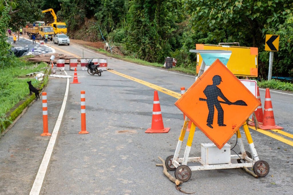
In work zones, you may encounter temporary pavement markings that override the permanent ones. These temporary markings are typically orange or white and may be accompanied by traffic control devices like barrels, cones, or vertical panels.
According to the Federal Highway Administration, there were 857 fatalities in work zones across the United States in 2020. This statistic underscores the importance of paying extra attention to pavement markings and other guidance in construction areas, where conditions can change rapidly and unexpectedly.
Conclusion
Pavement markings and lane controls represent a sophisticated system designed to guide traffic safely and efficiently. By understanding and respecting these visual instructions, drivers contribute to the orderly flow of traffic and reduce the risk of crashes.
The next time you’re on the road, take a moment to appreciate these silent guides beneath your wheels. They’re not just paint; they’re a crucial communication system that helps the complex choreography of traffic function smoothly across America’s nearly 4 million miles of roads.
Remember that while these markings provide guidance, they don’t eliminate the need for attentive driving. Always scan the road ahead, stay aware of your surroundings, and be prepared to adjust to changing conditions. The markings are there to help, but safe driving ultimately depends on the person behind the wheel.